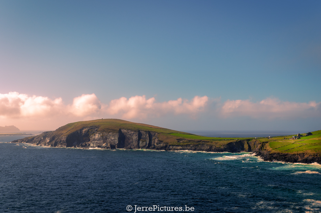
Dunmore Head, also known as ‘Ceann an Dún Mhóir’ in Irish, is a cape located on the Dingle Peninsula in County Kerry, Ireland. It is the westernmost point of mainland Ireland and marks the end of the Dingle Way, a popular hiking trail in the area.
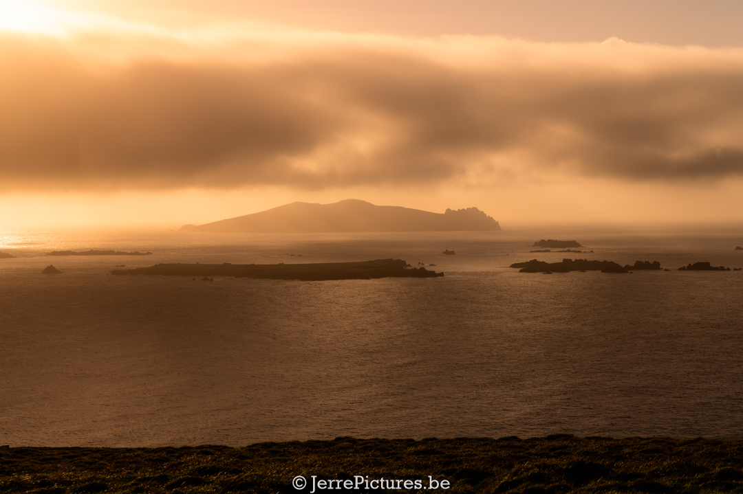
Dunmore Head offers breathtaking views of the Atlantic Ocean and is surrounded by rugged cliffs. It is a stunning place to enjoy the natural beauty of Ireland. On clear days, you can even see all the Blasket Islands, a group of uninhabited islands known for their rugged landscape and cultural history
In addition to its natural beauty, Dunmore Head also holds historical significance. Standing on Dunmore Head, on clear days, you can easily look towards Great Blasket Island, where the EIRE sign 38 is located.
Dunmore Head is a popular destination for hikers, nature enthusiasts, and photographers. It is a place where you can enjoy spectacular views and experience the peace and serenity of the Irish landscape.
Upon arriving at Dunmore Head, my girlfriend starts complaining about being hungry. I actually wanted to start taking pictures right away, but hey, sometimes you gotta give your girlfriend what she wants. She’s the sweetest woman on Earth, as long as she gets her food on time! And then something remarkable happens… out of nowhere, another couple began admiring our vehicle while we were preparing our meal. They asked us a few questions and that’s how we met Pat and Gail. I’ve mentioned them before – he’s a really nice guy and her knowledge of Irish history is immense. Whenever I’m unsure about something, I quickly shoot her a message. We immediately hit it off, like we’ve known each other for years. After our meal, we set off on our short hike, but let me tell you, the view we encountered was absolutely stunning. It was as if we had stepped into a painting!
Is it easily accessible by camper?
It is indeed easy to reach with the camper. There are some parking spaces available, but keep in mind that they may not be sufficient, especially during the peak season. We visited it during the off-season, and you can even easily stay overnight, but shhht 🤫, we didn’t say that out loud. Please note that this campsite is located very close to the coast, and it is usually quite windy, so a rooftop tent may potentially cause issues.
Soon, I’ll write more about the Blasket Islands because they truly deserve a post of their own. The story surrounding these islands is so captivating that it could almost be made into a movie.
A nerdy deep dive into Dunmore Head:
At Dunmore Head, you’ll find LOP38. To prevent the Germans from accidentally bombing neutral Ireland, the LOPs (Look Out Posts) were ordered to place ground signage nearby with the word “ÉIRE” written on them, which means “Ireland” in the Irish language. These ÉIRE signs were later numbered from 1 to 103 so that American planes could use them as a sort of GPS to determine their position. (At that time, there was no GPS as we know it today.) More information about these LOPs can be found in the following article: ‘From history to breathtaking views: The Bray Head Loop Walk on Valentia Island‘ (including a map with all LOPs in Ireland and their diaries)
In addition to LOP 38, you’ll also find the Coumeenoole Ogham Stone, which is a historical artifact located in the vicinity of Dunmore Head on the Dingle Peninsula in County Kerry, Ireland. Ogham stones are Irish stone monuments that contain inscriptions in the Ogham script, an ancient writing system used in the early Middle Ages.
The Coumeenoole Ogham Stone is a standing stone with an Ogham inscription on it. Ogham inscriptions consist of a series of lines and slashes carved into the edge of the stone. Each series of lines and slashes represents an Ogham letter, which in turn corresponds to a particular sound in the Irish language.
The specific inscription on the Coumeenoole Ogham Stone can vary, as multiple Ogham stones have been found with different inscriptions. The inscriptions on Ogham stones can include names, words, or other meaningful texts, but they are not always easy to decipher due to the limited information available about the Ogham script.
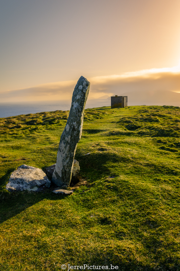
The Coumeenoole Ogham Stone is an intriguing historical and cultural artifact that bears witness to the ancient history and language of Ireland. It is worth visiting for those interested in the pre-Christian and early medieval history of the country. It is possible that the Coumeenoole Ogham Stone was placed at Dunmore Head due to the distinctive and beautiful surroundings in which it is located, making it an interesting attraction for visitors. Adding the Coumeenoole Ogham Stone to the landscape of Dunmore Head not only enhances its historical significance but also strengthens the appeal of the location for tourists and enthusiasts of culture and history. The convergence of breathtaking views, rugged cliffs, the historical fort, and the intriguing Ogham inscription makes Dunmore Head a unique destination that will captivate both nature lovers and history enthusiasts. It is a place where one can enjoy the stunning natural beauty while catching a glimpse of Ireland’s distant past. A visit to Dunmore Head and the Coumeenoole Ogham Stone is an opportunity to discover, explore, and savor the rich history and enchanting landscapes of this special part of Ireland.