The Bray Head Loop Walk on the beautiful Valentia Island is an experience you won’t soon forget. It’s a walk full of history, breathtaking views, and a unique atmosphere that you won’t find anywhere else.
It’s just past noon when I start my hike to the Bray Head Loop Walk on Valentia Island. Dark clouds loom menacingly above me, but I’m determined to complete this walk and discover what this place has to offer. I’m not alone, my girlfriend accompanies me on this expedition.
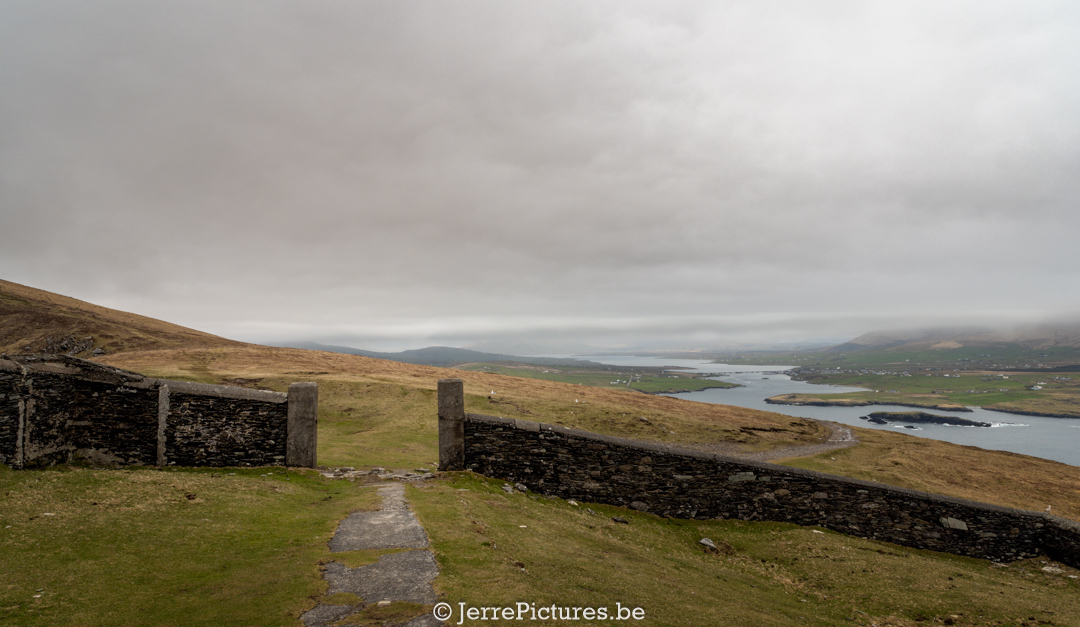
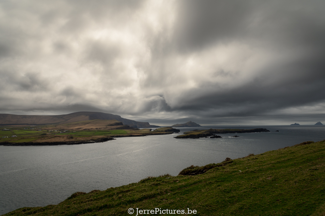
We begin our walk and the dark clouds put on a spectacular show above us. The walk is manageable and we steadily climb upwards. Most people walk to the signal tower and back, but there is also a loop walk you can do for a complete experience. A GPX file will be added at the bottom of the article.
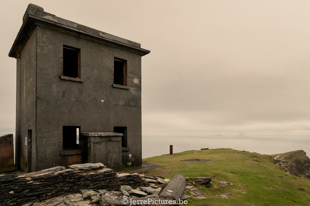
But before we begin, let’s talk about the history of the island. During World War II, Ireland was officially neutral, but the country was not immune to the threat of a German invasion. To combat this threat, Ireland built a series of concrete lookout towers on the mainland of the country, called Look Out Posts (LOPs), to monitor all activity along the coast and in the air.
However, the construction of some signal towers was long before WWII. During the Napoleonic Wars, the British authority that ruled Ireland at the time carried out a very similar building project and constructed towers on headlands around Ireland to watch for any signs of Napoleon invading Ireland.
During WWII, as mentioned, Ireland incorporated some of the original Napoleonic towers as LOPs. This was also the case at Bray Head, where there is also a 17th-century fort. The LOP was manned by a team of men from the island, who looked out for movements at sea and in the air 24 hours a day, 7 days a week. They kept detailed diaries of everything they saw and heard, and these diaries are now available online to the public.
This tower here was built in 1815 during the Napoleonic Wars. The tower was intended to transmit messages about ship movements and security issues between the coastguard posts and the capital city of Dublin. All this information was also passed on to the intelligence service of America. The tower has been restored and is open to visitors as part of the Valentia Island Heritage Centre, where you can also find information about the history and culture of the island.
To prevent the Germans from accidentally bombing neutral Ireland, the LOPs were instructed to place signaling on the ground nearby with the word “ÉIRE” written on it, which means “Ireland” in the Irish language. These ÉIRE signs were later numbered between 1 and 103 so that American planes could use them as a kind of GPS to determine their position. (At that time, there was no GPS, a kind of precursor to GPS, so to speak.)
After the war, the LOPs fell into disuse, and the ÉIRE stones were often overgrown with vegetation or used as building material. It wasn’t until the last decade that people became interested in this history again, and some communities began repairing and maintaining the ÉIRE signs.
All the LOPs of Ireland mapped
If you push the pin, you’ll get all the information about the LOP, such as GPS coordinates, as well as a link to the diary of that specific LOP.
Diary of LOP 35 (Bray Head)”.
map provided by: militaryarchives.ie
more info you can find here:Look-Out Post Logbooks (September 1939 – June 1945) | Reading Room Collections | Collections | Military Archive
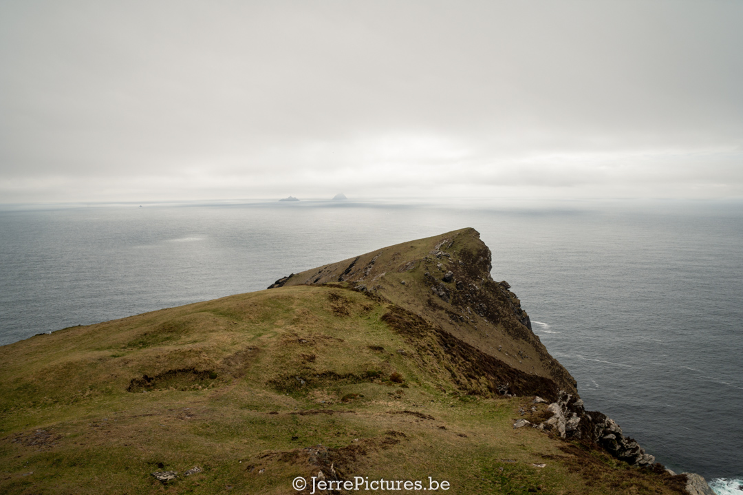
But enough history, let’s talk about the hike itself. The Bray Head Loop Walk is at least a 7 kilometer long hike that starts at the Bray Head car park. The hike takes you along the spectacular coastline of Valentia Island and offers breathtaking views of the Atlantic Ocean. As you can see in the attached photos.
Along the way, you’ll pass by the old LOP on Bray Head and the 17th-century fort. If you’re lucky, you might even catch a glimpse of the ÉIRE sign that is still visible on the ground. The Bray Head Loop Walk is without a doubt one of the most spectacular walks you can take on the beautiful island of Valentia in Ireland. It all begins at the picturesque harbor of Knightstown and takes you through the heart of the island’s wild, unspoiled nature. But the real highlight of the walk is the ascent of Bray Head, a mighty cliff that overlooks the Atlantic Ocean.
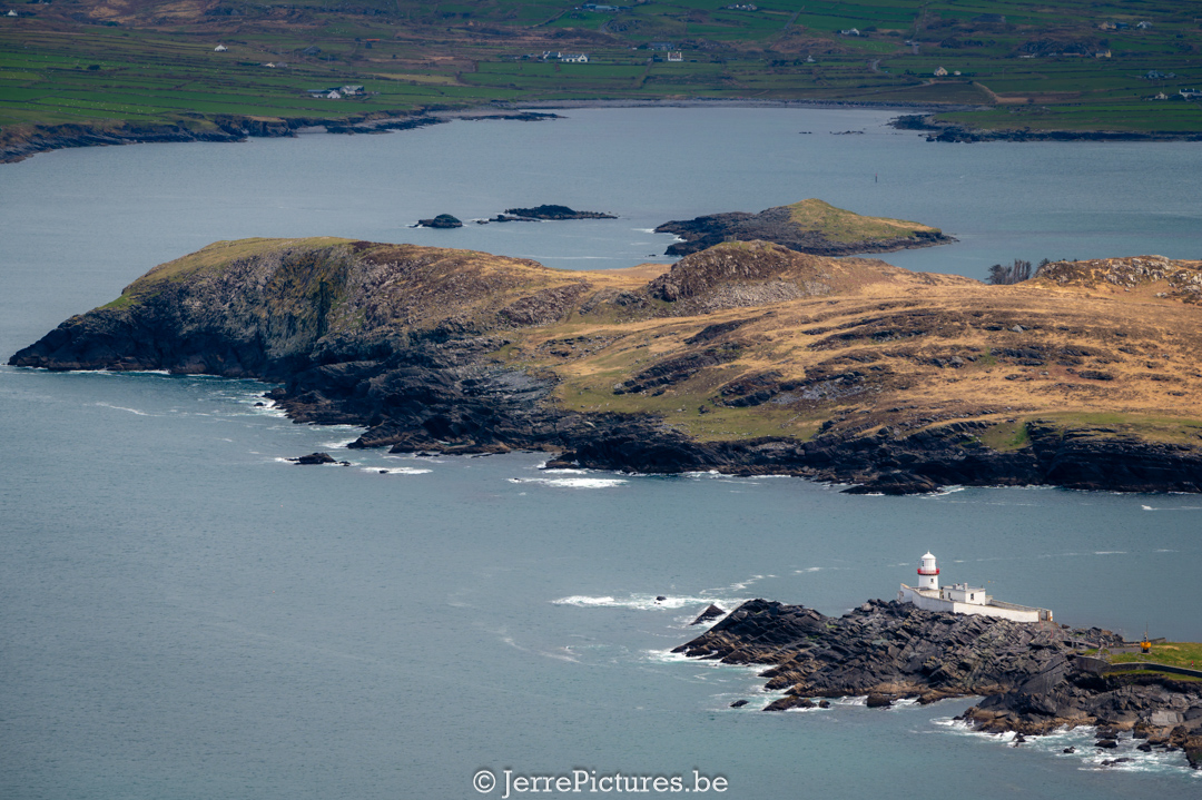
A little explanation about the lighthouse you’ll encounter on your walk to the signal tower on Bray Head. The lighthouse on Valentia Island is an iconic landmark that has been making shipping along the west coast of Ireland safer for over 200 years. The tower was built in 1841 and was initially manned by three lighthouse keepers who ensured that the lamps were lit and the foghorn was working.
Today, the lighthouse is automated and unmanned. The building itself has been restored and converted into holiday accommodation. Guests can stay there and enjoy the spectacular views of the Atlantic Ocean and the surrounding coastline. It’s a popular destination for tourists looking for a unique and peaceful holiday experience on a beautiful island in Ireland.
A word of gratitude!
During our trip to Ireland, we met Gail and Pat, a wonderful couple. Gail’s profound historical knowledge was truly remarkable, and much of the information in this article was shared by her. One of their hobbies involved locating the old LOPs and partially restoring them. Their historical expertise was of immense value to me.
Please check out their Instagram or YouTube accounts:
- Gaothmhor (@gaothmhor) • Instagram photos and videos
- Places to explore in Kerry (@explore.kerry) • Instagram photos and videos
- (14) Gaothmhor – YouTube
Thank you, Gail and Pat
The Fire of Aideen and the Origin of the Name “Bray Head”
“Know that Bray Head gets its name from the Irish term ‘Breo Aíd’, which means ‘Fire of Aideen’. The Fire of Aideen: different myths, one legend.
The Fire of Aideen is an iconic beacon on Bray Head, a headland located on the Irish island of Valentia. The name refers to the Irish princess Aideen, but there are different myths about the origin of the fire and the reason why it was named after her.
According to the first myth, Aideen was involved in the death of her beloved Oscar, grandson of the legendary warrior Fionn MacCumhaill. When she heard the news of Oscar’s death, Aideen died of grief. To honor her, the people at Bray Head lit a fire and called it the Fire of Aideen. This myth emphasizes the tragic love story between Aideen and Oscar.
Another myth claims that the fire was kindled to celebrate the safe return of the Irish hero Cúchulainn after he had defeated an enemy warrior. In this version of the story, Aideen is not mentioned, and the fire is a symbol of the triumph of the Irish heroes.
A third myth tells the story of the warrior Lugh, who lit the Fire of Aideen to celebrate his victory over the Fomorians, a mythic sea monster. In this version of the story, Aideen has no role, and the fire symbolizes Lugh’s triumph over the Fomorians.
Finally, the most beautiful myth is from the Ulster Cycle epic. It’s about Aideen, the daughter of the king of Leinster, who falls in love with the warrior Cú Chulainn. However, Cú Chulainn is obliged to fight against her father in a war between the kingdoms of Ulster and Leinster. Aideen begs him not to fight, but he cannot escape his duty.
Aideen then devises a plan to stop the war. She asks her father to build a tower on the coast of Leinster and light a fire on top of it when the battle is over. That way, Cú Chulainn can see that he no longer needs to fight and can safely return to Ulster. The plan works, and the war stops. Since then, the Fire of Aideen has stood for peace and love in Ireland.
The name “Bray Head” comes from this legend, as the tower that Aideen had built and on which the fire was lit likely stood at this location.
Although these myths differ in details, they all share a common element: the Fire of Aideen is a symbolic fire that represents triumph and victory. Whether kindled in honor of Aideen’s love, the return of Cúchulainn, or the victory of Lugh over the Fomorians, the fire remains an important feature of Irish mythology and a reminder of the heroes and their achievements.
Over the centuries, the Fire of Aideen has found its place as an iconic element of Bray Head and Valentia Island. Although the origin of the fire may be uncertain, it remains a fascinating legend that continues to captivate people’s imaginations.”
PLEASE NOTE:
There is another walk with the name Bray Head Loop Walk. That one is in Bray, which is near Wicklow. This walk also offers stunning views and is definitely worth exploring. Some maps call it now Breay Head Cliff Walk
However, the name “Bray Head” is not derived from a myth, but from the River Bray that flows through it. Although the names are similar, the locations are about 350 km apart and each has its own unique features and attractions.
Here are the GPS coordinates for the lighthouse in Bray: Latitude: 53.1943 Longitude: -6.1008
- GPS FOR START POINT:
53°11’46.8″N 6°05’31.5″W