While in my opinion, I was behind schedule (especially considering the limited time I had for my journey), I decided to drive longer during the day. I always cover a lot of ground when I travel solo, but I know my friends can’t handle that as well. They prefer longer stops at certain places. Unfortunately, from my own experience, I know that we won’t get to see as much of a place if we linger too long. I understand the pressure of extensive travel weighs heavily on her (not to mention the reduced frequency of meals). I don’t need as much food because we simply don’t burn calories while driving, but every individual is different, and since I continue to travel with her, I have to compromise somewhere. I had underestimated the Alps. I thought I had learned my lesson after a trip a few years ago when I departed from Bergen heading to Narvik, and I completed that journey in just one day! This was in October with heavy snowfall on the Arctic Circle. By evening, Silje (a Norwegian friend who lives in Narvik) had to help me out of the car. But that’s another story for another time. Why am I telling you this now? The progress you make elsewhere on Western European roads will certainly not be the same here. You’ll have to learn to measure your journey in hours rather than kilometers; 150 kilometers a day is the maximum you can sometimes do if you still want to engage in side activities.
In the afternoon, we drove through the Col Du Chaussy. It immediately became clear to me that this isn’t as spectacular a route as the Col Du Galibier. That doesn’t mean it lacks charm; oh no, it has a certain something reminiscent of a scene from Heidi in the mountains. And this isn’t meant as a slight, but rather a dreamy enchanting image, a place where you can peacefully and carefreely enjoy everything.
Capturing the Enchanting Col Du Chaussy
A nerdy Deep dive into Col Du Chaussy:
Col du Chaussy is located in the municipality of La Tour-en-Maurienne, belonging to the Savoie department in the Auvergne-Rhône-Alpes region of France. Situated in the Maurienne valley, northeast of Saint-Jean-de-Maurienne.
The municipality was formed on January 1, 2019, through the merger of the towns of Le Châtel, Hermillon, and Pontamafrey-Montpascal. It covers an area of 40.96 km² and has approximately 2,000 inhabitants.
La Tour-en-Maurienne is a popular destination for winter sports enthusiasts. The municipality boasts two ski areas: Le Châtel and Le Grand Coin. In summer, it serves as an excellent base for hiking and cycling in the Maurienne.
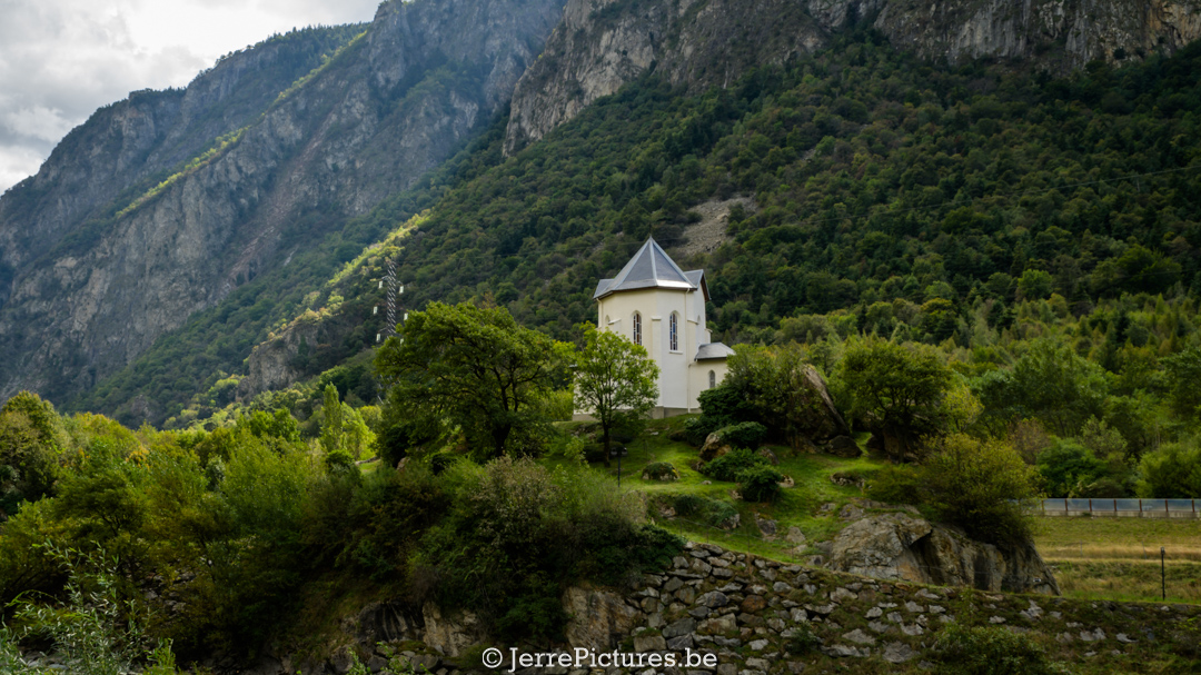
Situated at 1533 meters on the col is a simple small chapel located at the edge of the Col du Chaussy, the starting point for the popular hike to the summit of the Grand Coin in the French Alps. The chapel is dedicated to Saint Antoine de Padoue, the patron saint of travelers. Come on, let’s be honest, this is something we shouldn’t miss at the beginning of our journey, right?
Upon reaching the top, we also encountered a magnificent dog breed. One of them lay on a large stone overlooking the entire meadow. If I had my camera at hand, I could have recreated the cover of The Lion King with this big fellow, which you’d typically expect to find in the Pyrenees but less so here. Specifically, the Great Pyrenees Mountain Dog. However, we decided not to tempt fate and let the animals do their job; they made it clear they wanted their distance and were serious about their duties.
We continued our journey and eventually reached Lacets de Montvernier, which is truly a delightful pass, simply because of its steepness and the fact that it’s something different. I’m aware that I should be grateful for the limited number of oncoming vehicles, and given the time of year, it was also ideal that we didn’t encounter many cyclists.
What you need to know:
- Lacets de Montvernier is a mountain route with hairpin bends in the Alps, located in the Savoie department in France.
- The road is 3.4 kilometers long and covers an elevation difference of 277 meters.
- The road connects the municipalities of Pontamafrey-Montpascal in the valley to Montvernier atop the alp.
- The road was constructed between 1928 and 1934 and is considered one of the most spectacular mountain roads in the Alps according to some tourists… okay, I think I may disagree with this, but that doesn’t mean it’s not worth experiencing.
The road winds through the mountains, offering breathtaking views of the surrounding valleys and peaks.
Lacets de Montvernier is a popular destination for hikers, cyclists, and motorcyclists. The road is also a challenge for car racers and was used in the Tour de France in 1993.
Here are some interesting facts about Lacets de Montvernier:
- The road consists of 18 hairpin bends, with the first 13 laid out in a straight line.
- The road has an average gradient of 8.1%.
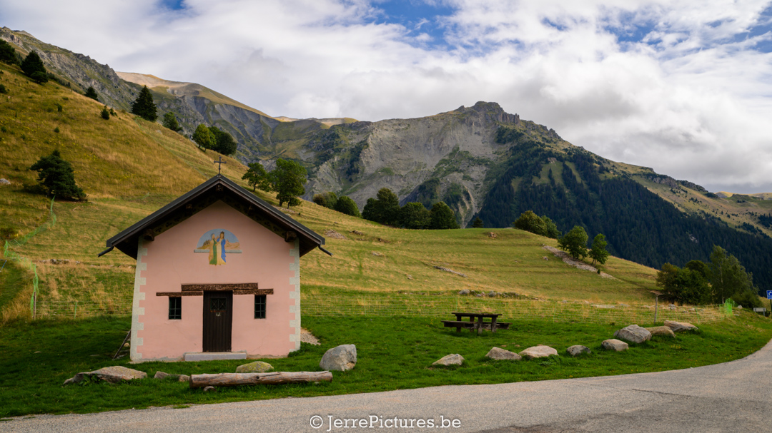
Finally, we arrived at Chapelle de l’Immaculée Conception. A chapel from 1854 that was renovated in 1990.